I’m a bit frustrated when I pin and set a location to take a picture of the moon and it is way off from what the map is showing. Is there something I need to do to have better accuracy ?
Hi @farwest - I’d need a few more details in order to comment: can you give an example, including a screenshot and indicate what you expected to see vs what you actually experienced?
Usually when the moon appears in a different part of the sky than expected, it’s due to a few things:
- There’s no clear view to the horizon, so moonrise occurs without a clear line of sight and then the moon appears later and in a different direction when it clears the obstruction (e.g. a hill or ridge)
- Clouds blocking the moon near the horizon - similar effect to point 1.
- If you rely on Augmented Reality in the iOS app and haven’t calibrated, then the direction can be inaccurate if your phone is affected by magnetic fields or nearby metal objects/structures (e.g. being inside a car)
We have an article that goes into this in more detail and sets out the sort of things to check.
Let me know a few more details and I’ll be more than happy to try to help get to the bottom of it with you!
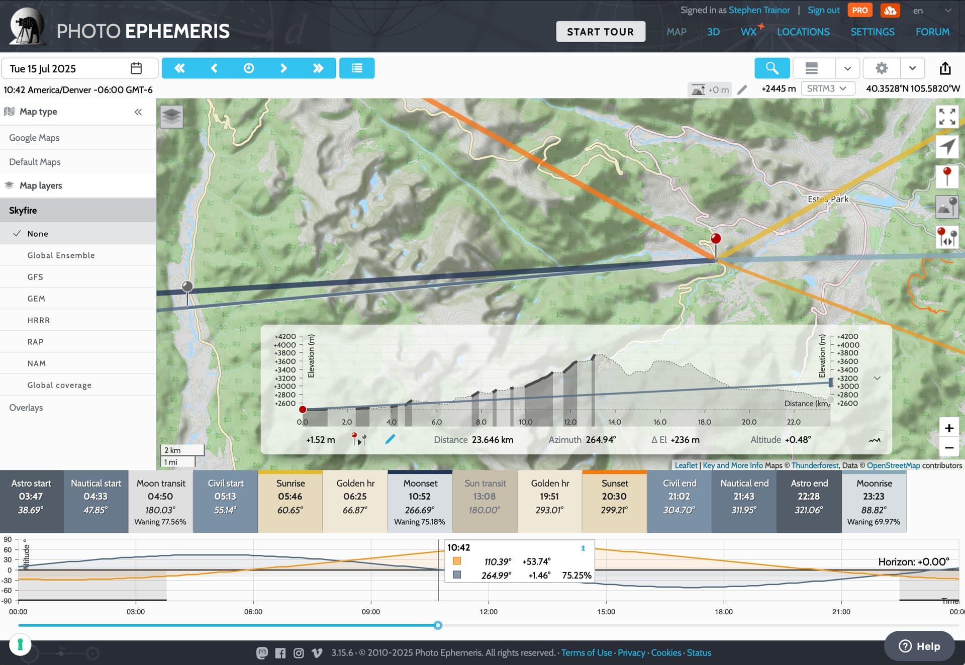
Here’s an example of what I mean: here the Moon is setting at 10:52, but it is obstructed by mountains long before the official time of moonset:
Thank you so much for your reply. I was wanting to get a photo of the moon coming up over a mountain peak. So from my house location I was to far south so I kept moving the pin north until the route lined up right over the peak. When the moon started to rise I was still to far south so I drove north about 1/4 to 1/2 a mile which worked because the peak is higher than where it first started to come up. The peak is little over 9000 ft and I’m at 5000 ft. I will try to get a screen shot to send you.
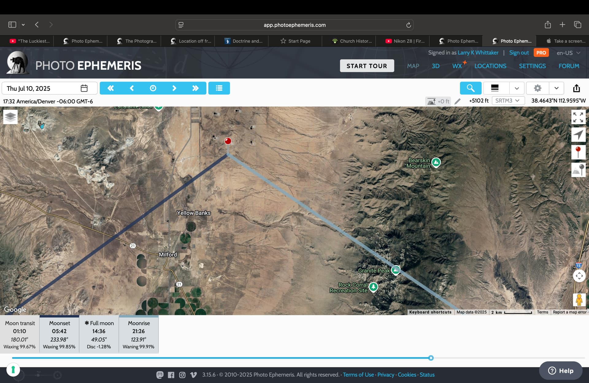
There’s the screen shot
Hi @farwest,
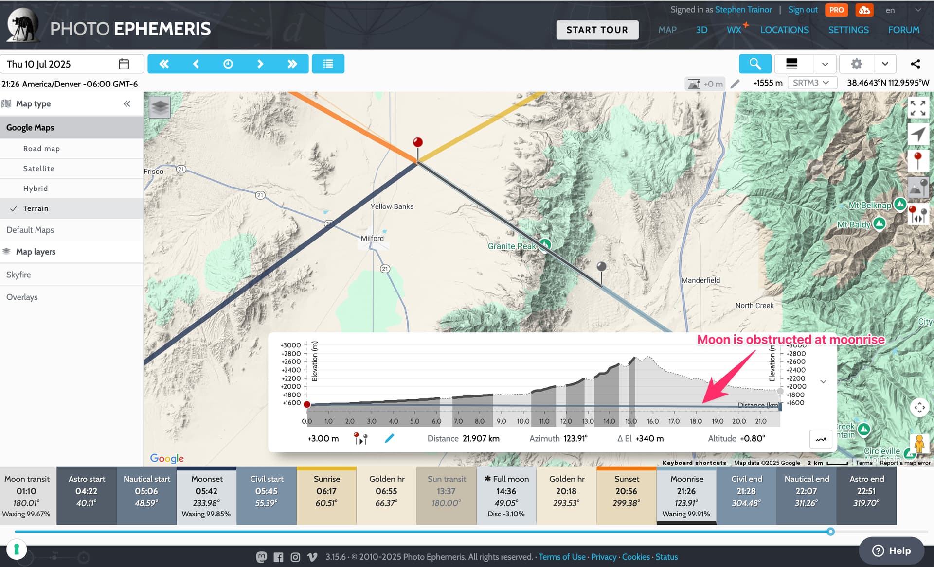
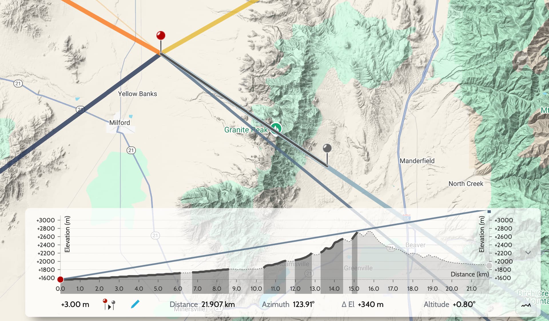
This is the classic case of the moon being obstructed at moonrise - remember moonrise, moonset, sunrise, sunset are all defined as being when the body rises above or sets below the unobstructed horizon. The horizon here is obstructed by Granite Peak (plus much of the rising foreground) - see the illustrations from our previous discussion here.
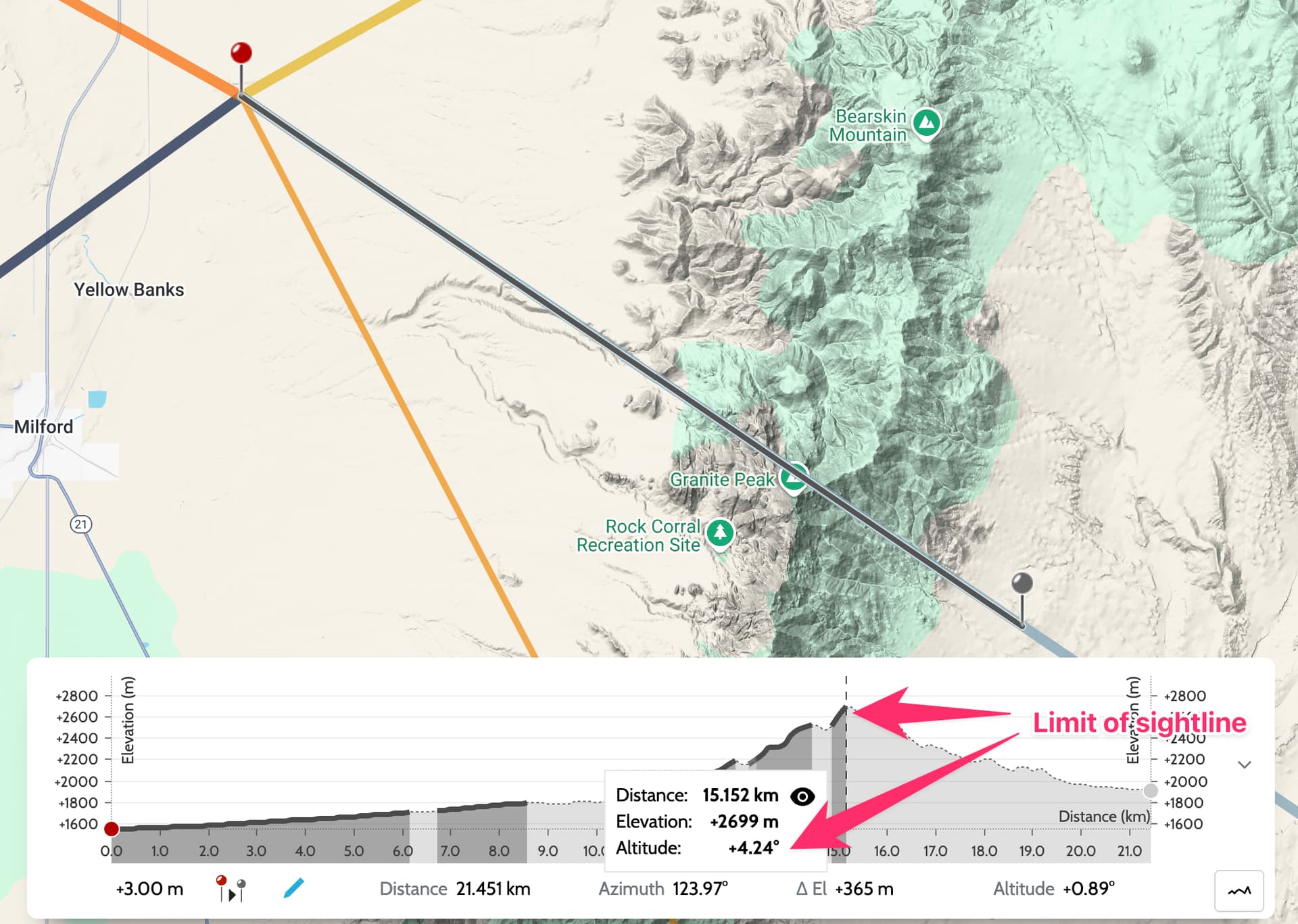
It’s clear to see when you use the sightline analysis tool:
You would need the moon to be much higher in the sky for it be visible. How high? Well, the tool will tell you - just hover on the chart at the point representing the limit of the visible sightline (the solid part of the elevation profile), and altitude from your shooting location is indicated: +4.24 degrees
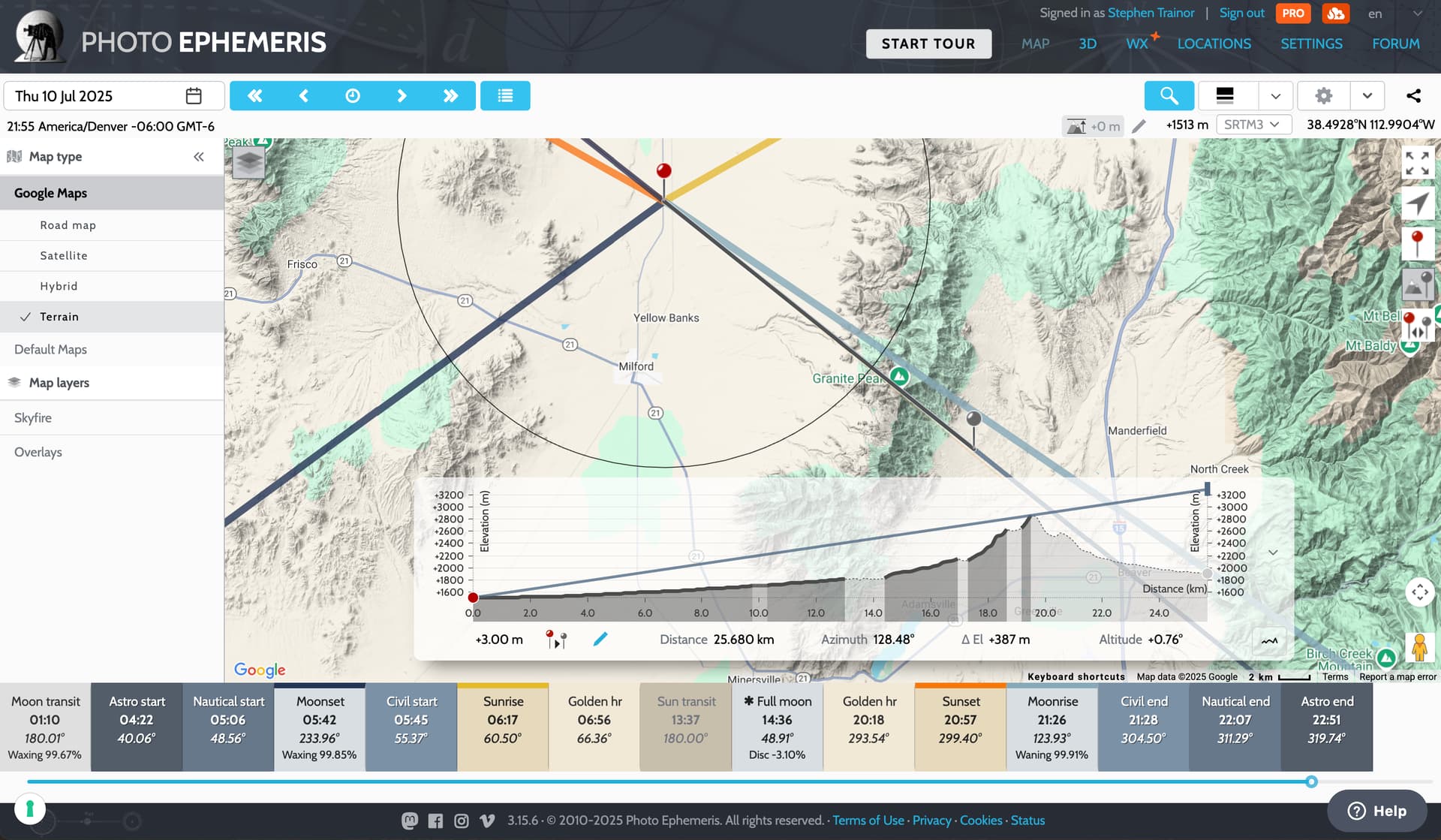
Of course, by the time the moon reaches that altitude (around 30 minutes after official moonrise), it has moved farther to the south:
Hence, the need to move to the north, and also a little farther west by the roadside helps:
You can learn more about using the Geodetics and Sightline tools here:
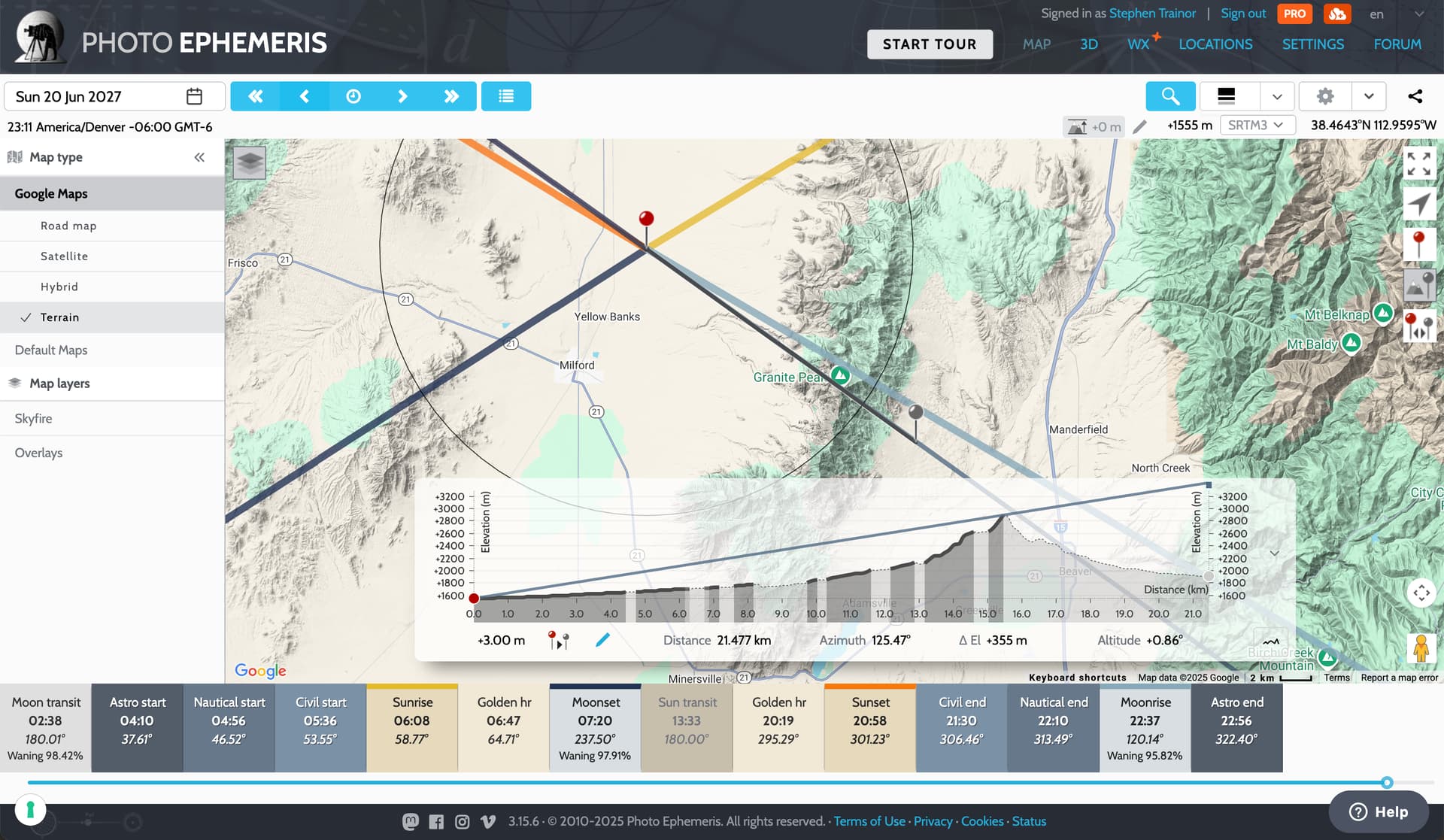
Alternatively, going back to your original shooting location, you can use Visual Search to find dates when the moon will be visible exactly in the right spot - Sunday 20 June 2027 works perfectly:
1 Like