Hi @farwest,
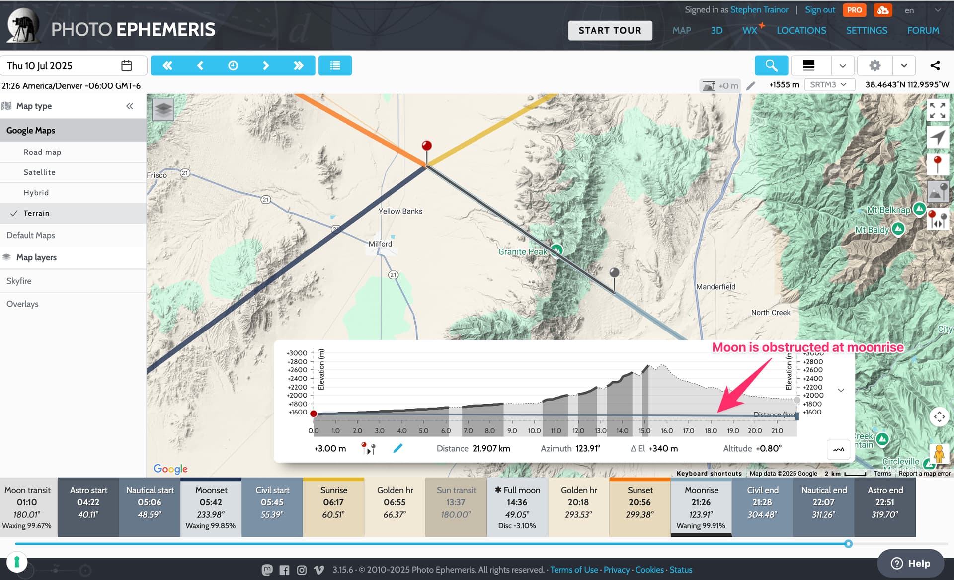
This is the classic case of the moon being obstructed at moonrise - remember moonrise, moonset, sunrise, sunset are all defined as being when the body rises above or sets below the unobstructed horizon. The horizon here is obstructed by Granite Peak (plus much of the rising foreground) - see the illustrations from our previous discussion here.
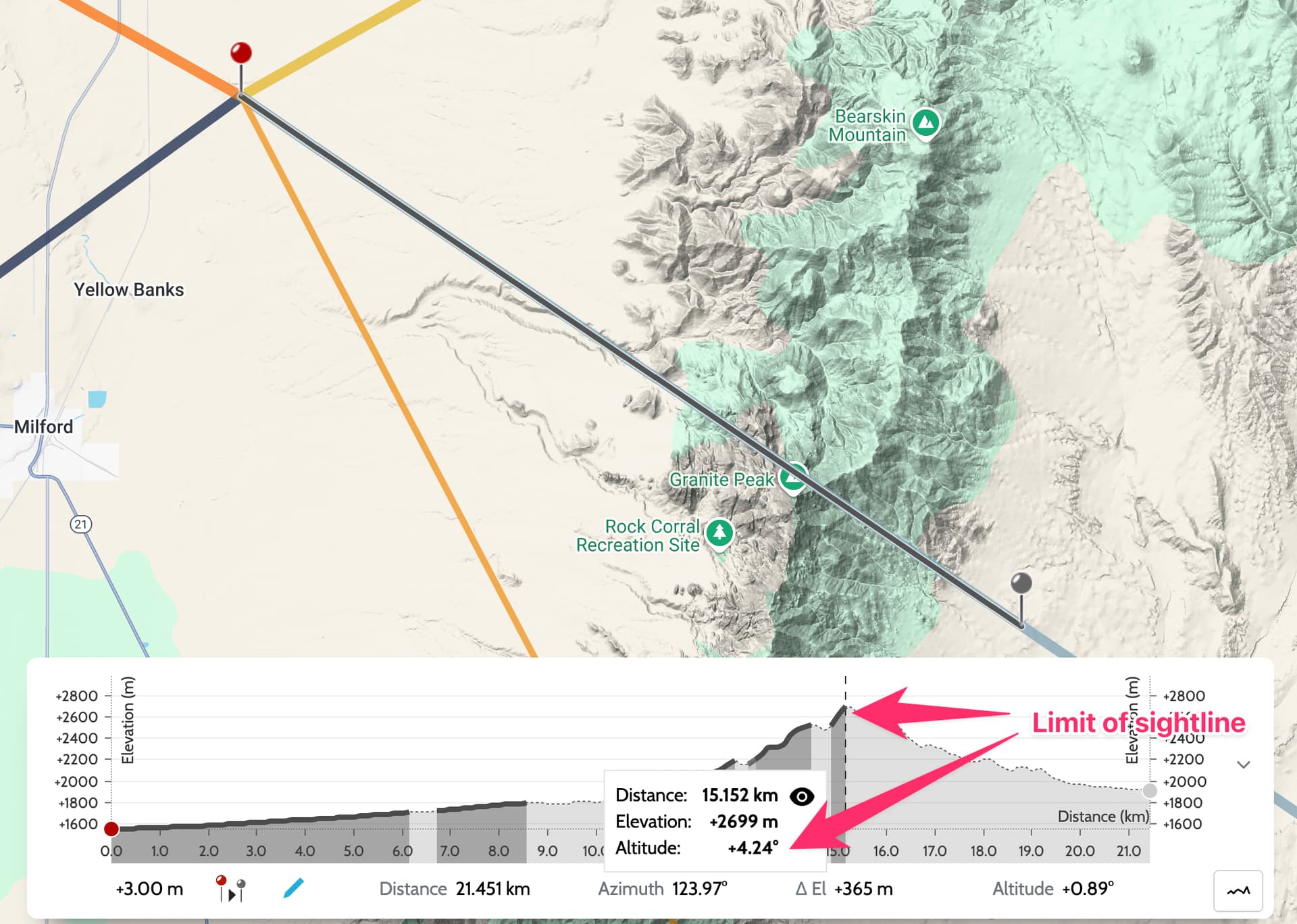
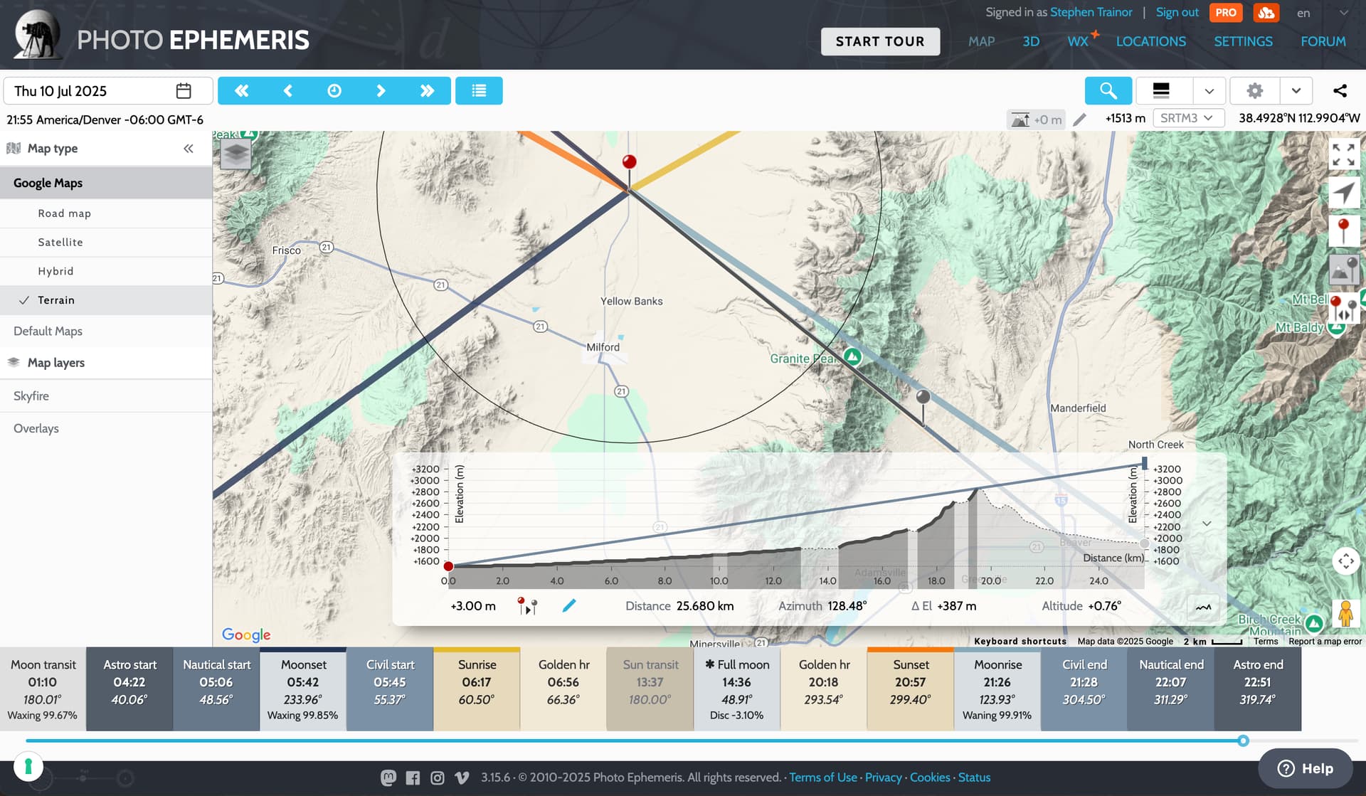
It’s clear to see when you use the sightline analysis tool:
You would need the moon to be much higher in the sky for it be visible. How high? Well, the tool will tell you - just hover on the chart at the point representing the limit of the visible sightline (the solid part of the elevation profile), and altitude from your shooting location is indicated: +4.24 degrees
Of course, by the time the moon reaches that altitude (around 30 minutes after official moonrise), it has moved farther to the south:
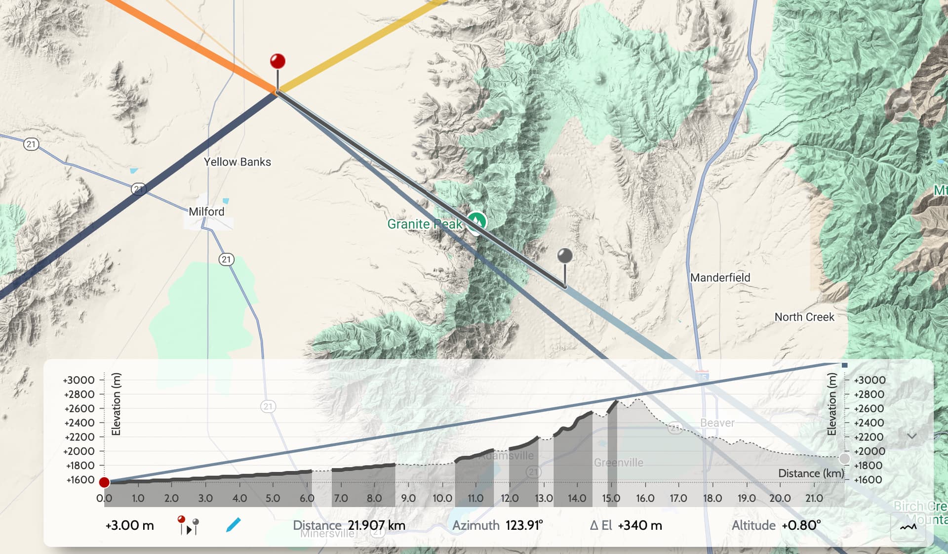
Hence, the need to move to the north, and also a little farther west by the roadside helps:
You can learn more about using the Geodetics and Sightline tools here:
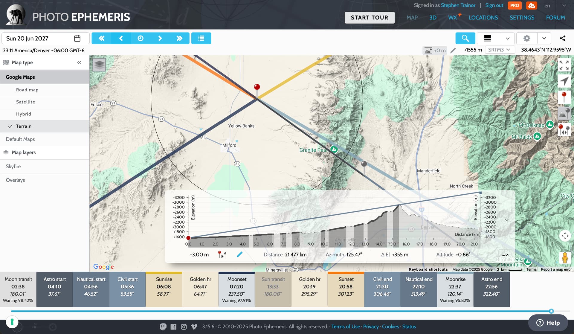
Alternatively, going back to your original shooting location, you can use Visual Search to find dates when the moon will be visible exactly in the right spot - Sunday 20 June 2027 works perfectly: