Hello! I have my primary pin on land which borders a body of water. I want to place my secondary pin on the deck of a bridge which spans the water. The problem is, when I place the secondary pin over the water where the bridge is, before I make any adjustment, TPE gives it a starting elevation of over 200 feet below the water level. I tried different maps, and the result is the same. It seems like maybe TPE is giving the secondary pin an elevation of the land beneath the water? This seems wrong. How can I get TPE to use the elevation of the body of water for the secondary pin?
Hi @sjpschmid – welcome to the forum!
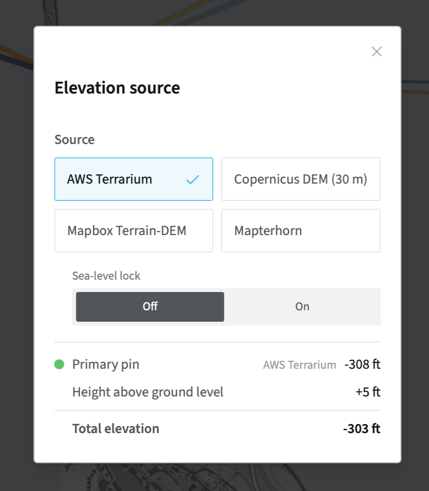
There’s a “Sea-level Lock” option for this situation. When it’s off, you may see negative values (some of the elevation data sources include bathymetry, e.g. the AWS Terrarium option:
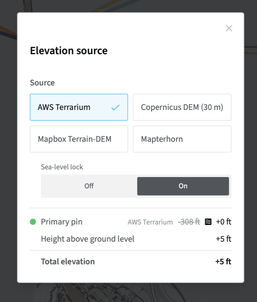
When you enable Sea-level lock, it is clamped to no less than zero:
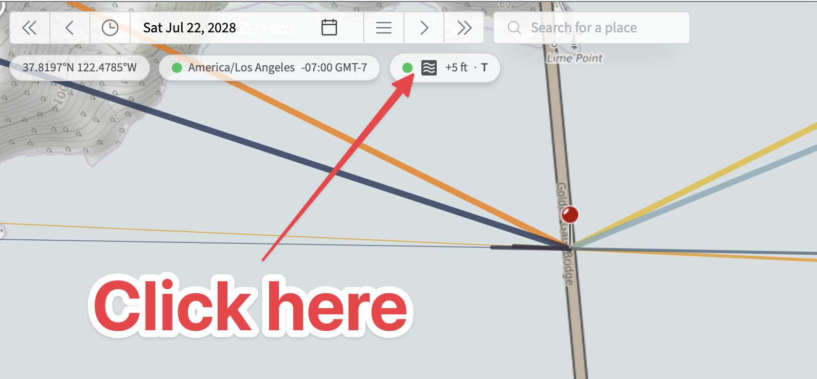
You can access that option in two places:
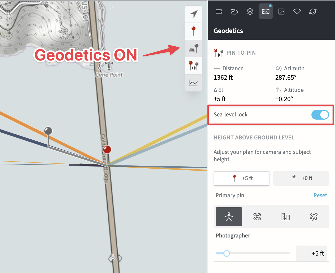
Alternatively, when Geodetics is ON, you can also control it via the Geodetics right-hand panel:
If you ever visit Death Valley or the Dead Sea, remember to turn sea-level lock to OFF!
Let me know if that helps!
Stephen
Hi Stephen. Thank you so much for your response, I really appreciate it! So I did see the sea level lock when I was trouble-shooting, but it does not solve the problem. The secondary pin is shown at negative elevation regardless of whether the sea lock is on or off. I have attached a screen shot of my situation. The land is the Marin County Headlands, and the bridge is the Golden Gate Bridge.
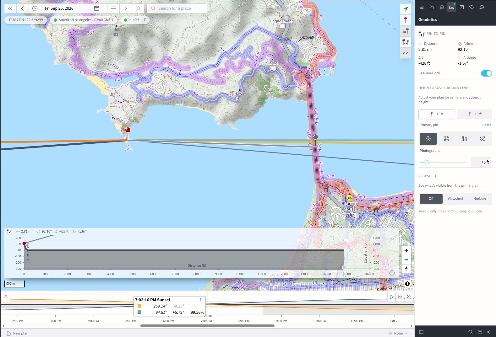
I see the issue. The quickest workaround is to switch to a DEM that doesn’t include bathymetry - I’d suggest Mapterhorn (it’s more accurate and higher resolution and is a good default choice for MAX subscribers).
If you click the elevation badge, you can switch there.
I’ll get the arithmetic problem fixed in the 4.8 beta in the meantime. Sorry you ran into that! I think I’ve been using Mapterhorn now for so long, I missed the problem!
1 Like
Wonderful. Thank you so much for your help, Stephen. And thank you for creating this great tool!
1 Like