TPE Web 4.9.0 Beta
The first beta of TPE Web 4.9 is now available at beta.photoephemeris.com. It’s another big release, but focused on improvements to existing functionality as opposed to major new features.
This release introduces split-screen maps for precise pin placement, major improvements to distant terrain and skyline rendering in 3D, and more accurate astronomical calculations, particularly around the horizon and at high latitudes.
There are also improvements to Field of View controls, map consistency, and a collection of bug fixes.
New: Split-screen maps for precise pin placement
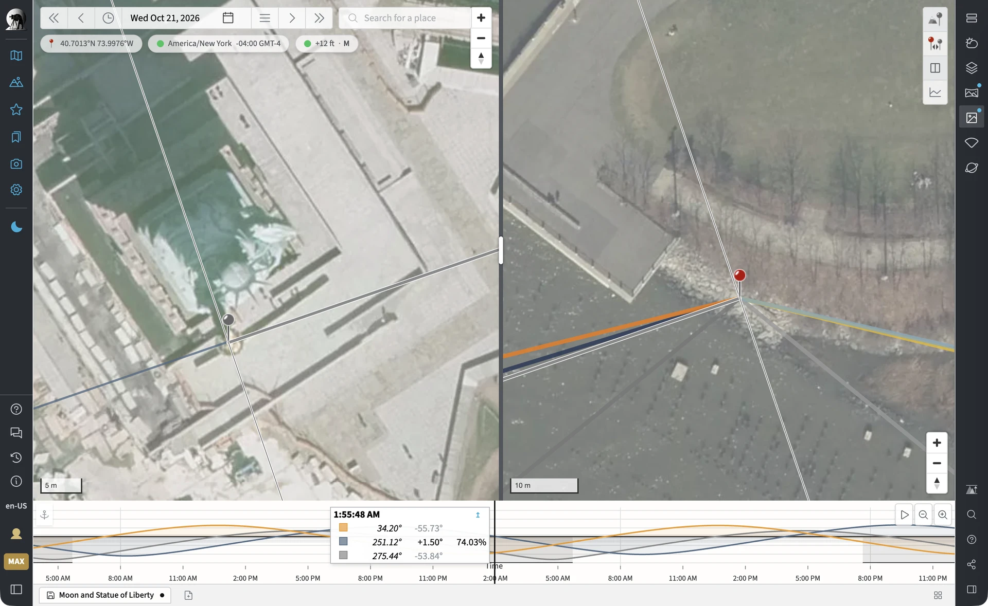
With Geodetics enabled, you can now split the main map into two maps side by side, each centered on one of your pins.
This is particularly useful when planning shots involving distant landmarks. Previously, positioning both pins precisely could involve repeatedly zooming and panning between the camera position and your subject.
Now you can see both locations simultaneously, zoom in independently, and fine-tune each pin without losing sight of the other.
- Each map initially zooms in on its respective pin.
- Drag the divider to adjust how much space each map occupies.
- Both maps display the pins, sight line, azimuth lines and Field of View overlay.
- Your map framing is preserved when switching between split and single-map views.
- Works with both the standard map and Google Maps.
Dock the map alongside the 3D view and simulators
The mini-map on the 3D, Moon Simulator, Eclipse Simulator and Celestial Targets pages can now expand into a docked map alongside the main view.
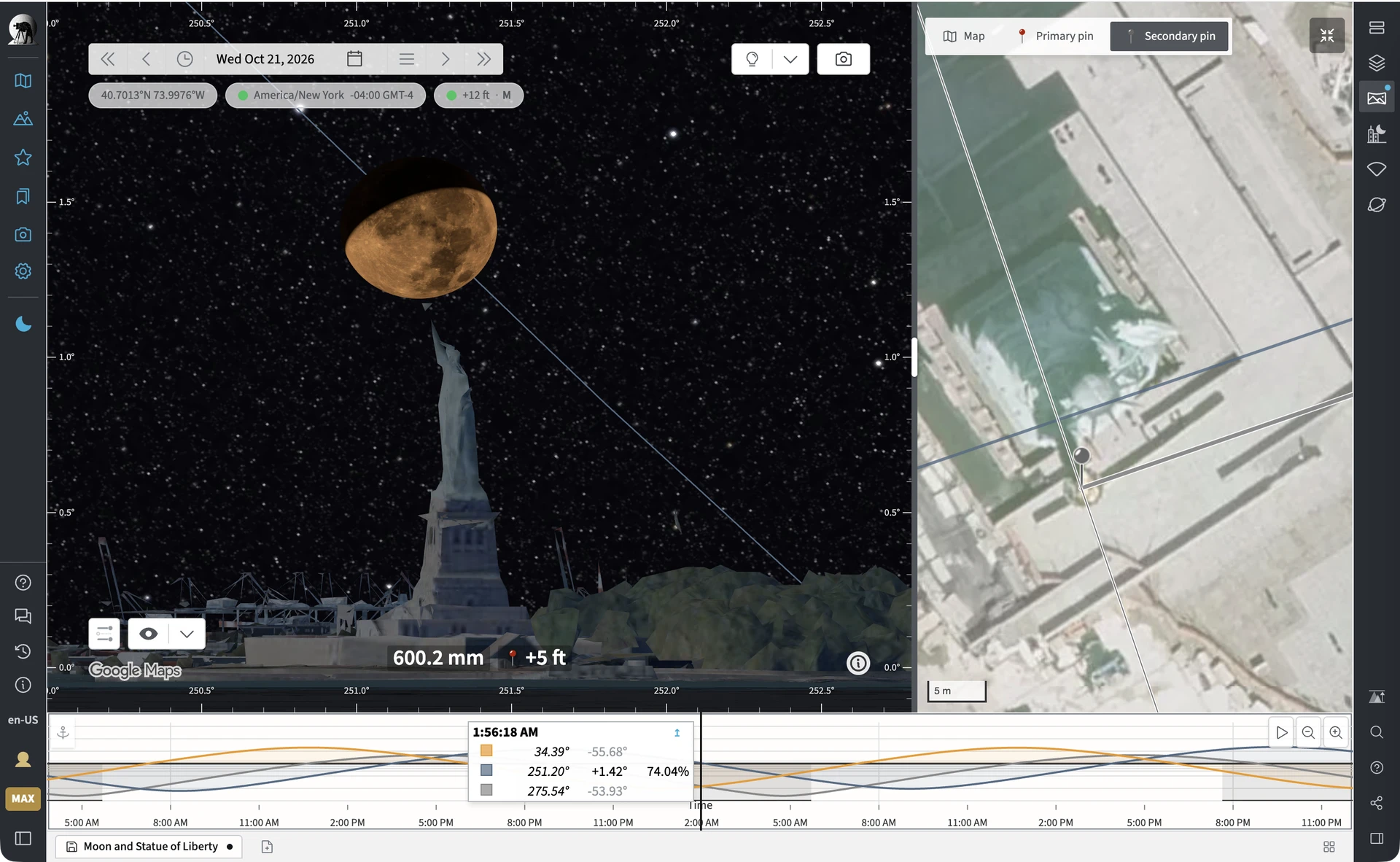
Previously, expanding the mini-map took you back to the main map page. Now you can keep the map and your current planning view visible simultaneously.
The divider is adjustable, and the docked map can focus on either the primary or secondary pin when Geodetics is enabled.
The mini-map also now respects your selected map provider. If you’re using Google Maps, the mini-map uses Google Maps too.
Major improvements to distant terrain in 3D
We’ve made substantial improvements to how TPE renders distant terrain in the 3D First Person View, particularly when using long focal lengths.
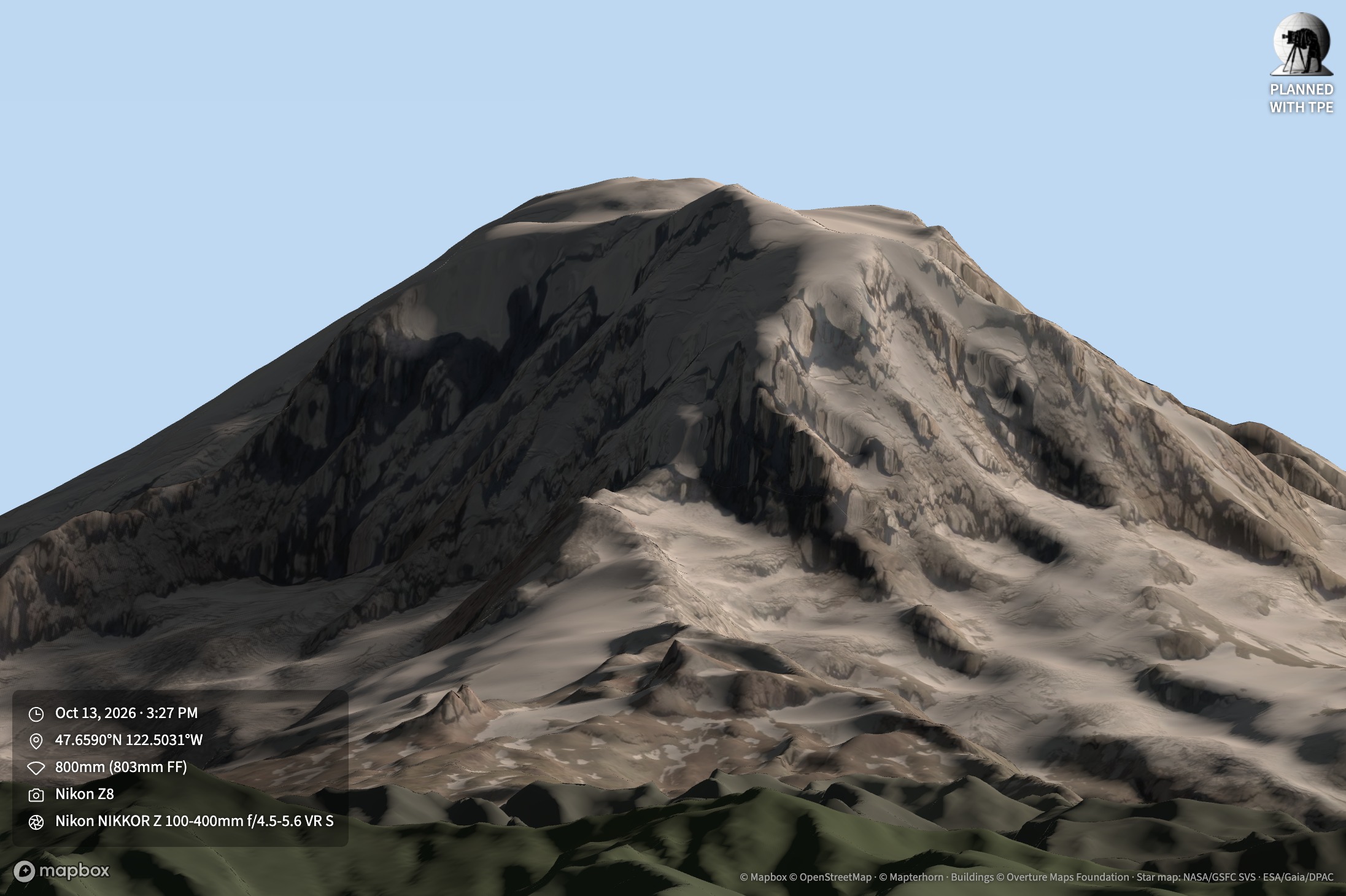
Previously, terrain detail could be insufficient at extreme distances, resulting in distant ridges and summits appearing lower or less precisely defined than they should. TPE now increases terrain detail according to the focal length you’re using, prioritizing distant skyline features that are in the field of view.
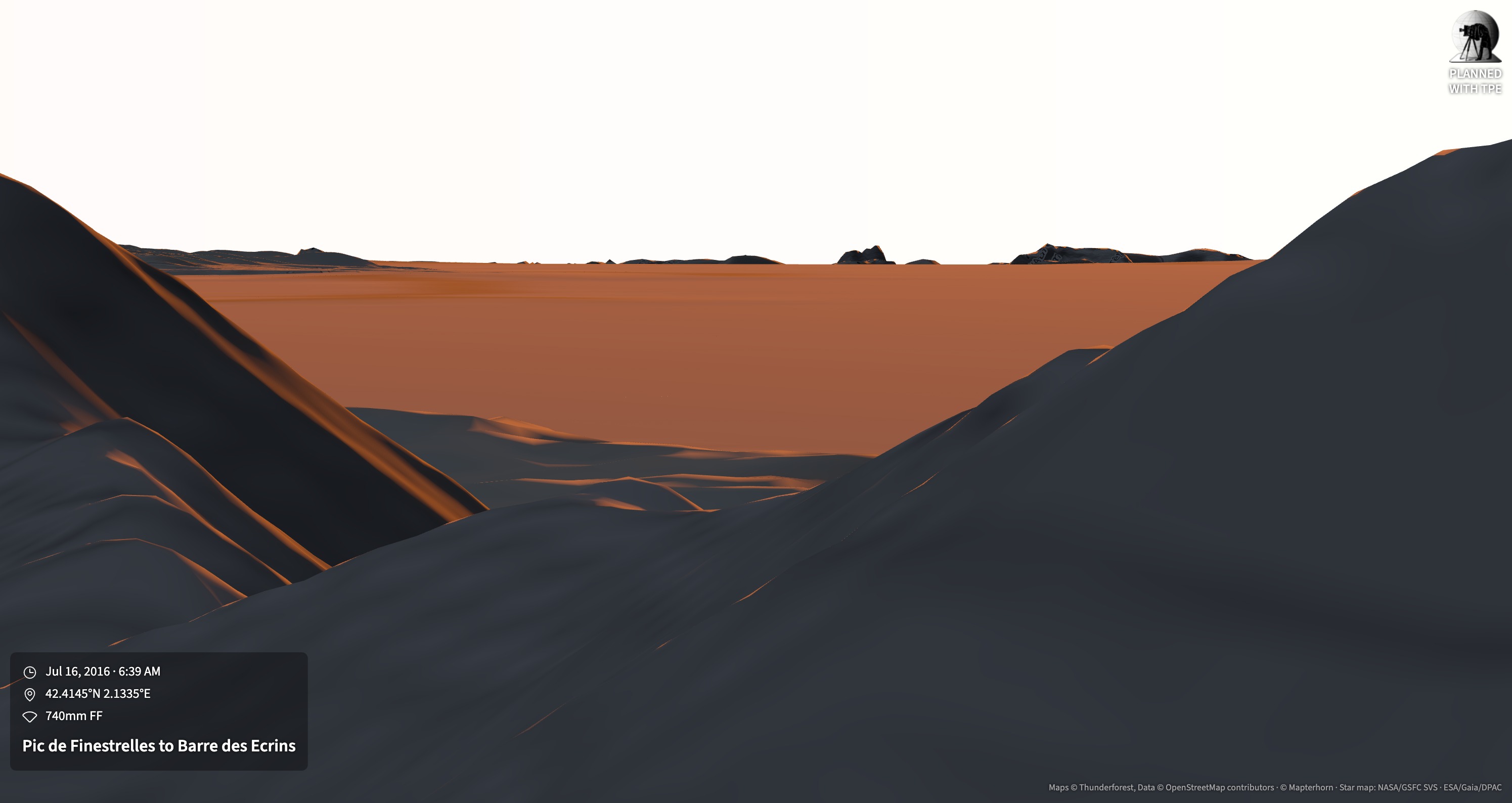
This example represents the 2016 world record distance sightline shot, covering some 443km:
Other improvements include:
- Terrain extends to the visible horizon, including from high-altitude viewpoints where the horizon may be hundreds of kilometres away.
- Distant mountain peaks that rise above the local horizon are included, even when they lie beyond the ordinary geometric horizon.
- Map imagery on distant slopes is rendered at higher detail when using long lenses.
- 3D buildings can now appear at much greater distances, including skylines such as Chicago viewed from across Lake Michigan.
- Several rendering artefacts affecting distant terrain have been eliminated.
These changes make the First Person View significantly more useful for planning precise telephoto compositions involving distant mountains, skylines and other landmarks.
More accurate Sun, Moon and planet positions near the horizon
TPE 4.9 incorporates substantial improvements to our astronomical calculation library, particularly in how atmospheric refraction is handled.
Refraction bends light as it passes through the atmosphere, affecting the apparent positions of celestial objects near the horizon and the apparent shape of the Sun and Moon. The updated calculations provide more accurate results for observers at high elevations and for bodies near or below the astronomical horizon.
This affects several areas of TPE:
- Sun, Moon and planet positions near the horizon
- Rise and set times from elevated viewpoints
- Visual Search results near and below the horizon
- Terrain Shadows and Target Visibility calculations
- Shot Alignment calculations involving low-altitude targets
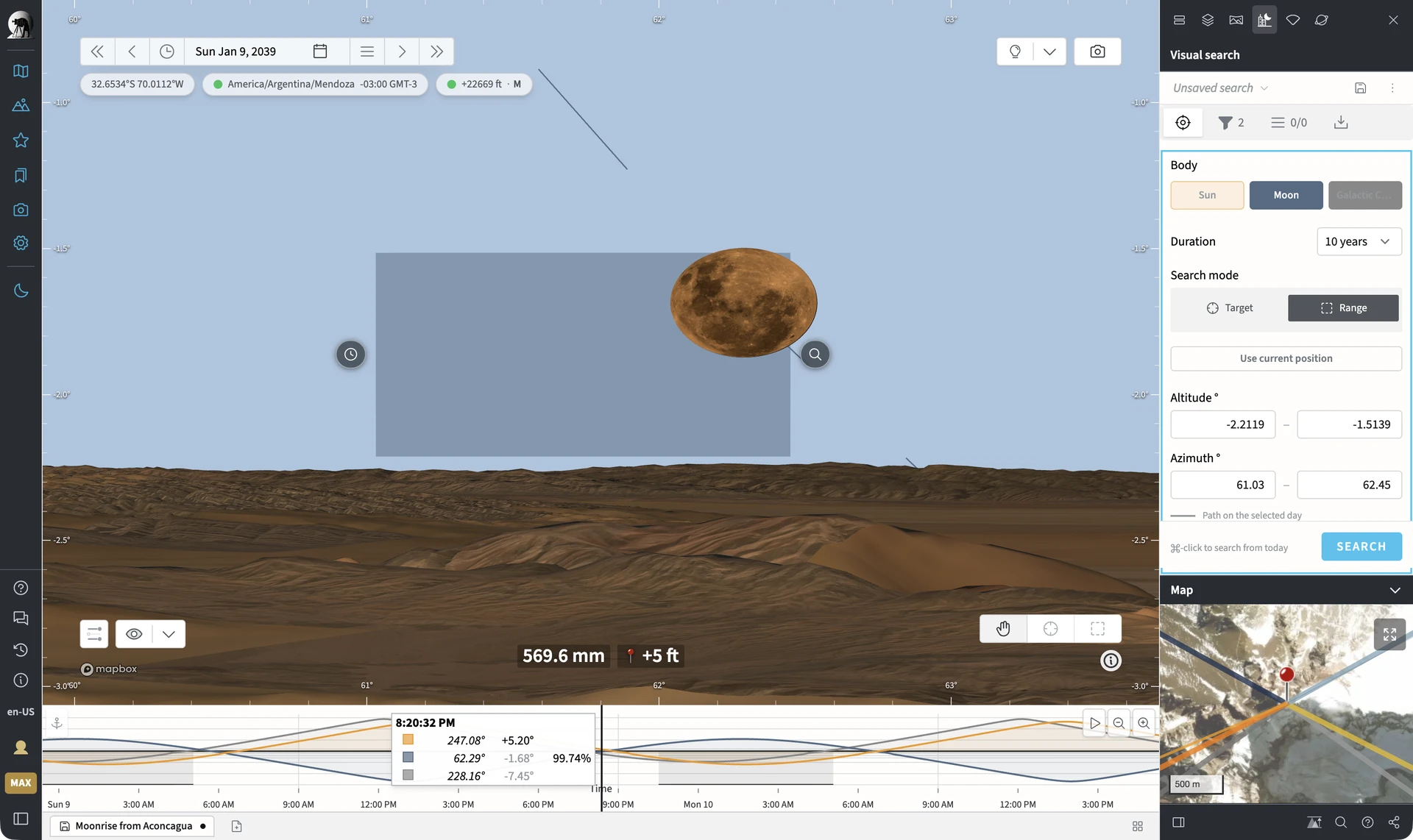
Visual Search can now search down to -5° apparent altitude, making it possible to find alignments below the astronomical horizon that may still be visible from elevated viewpoints, such as this search for altitudes between -2.2 and -1.5°:
We’ve also fixed several issues affecting Visual Search results near due north and for bodies passing high overhead.
The Sun and Moon now flatten near the horizon
One visible consequence of atmospheric refraction is that the Sun and Moon appear vertically compressed when close to the horizon. TPE’s 3D views now reproduce this effect.
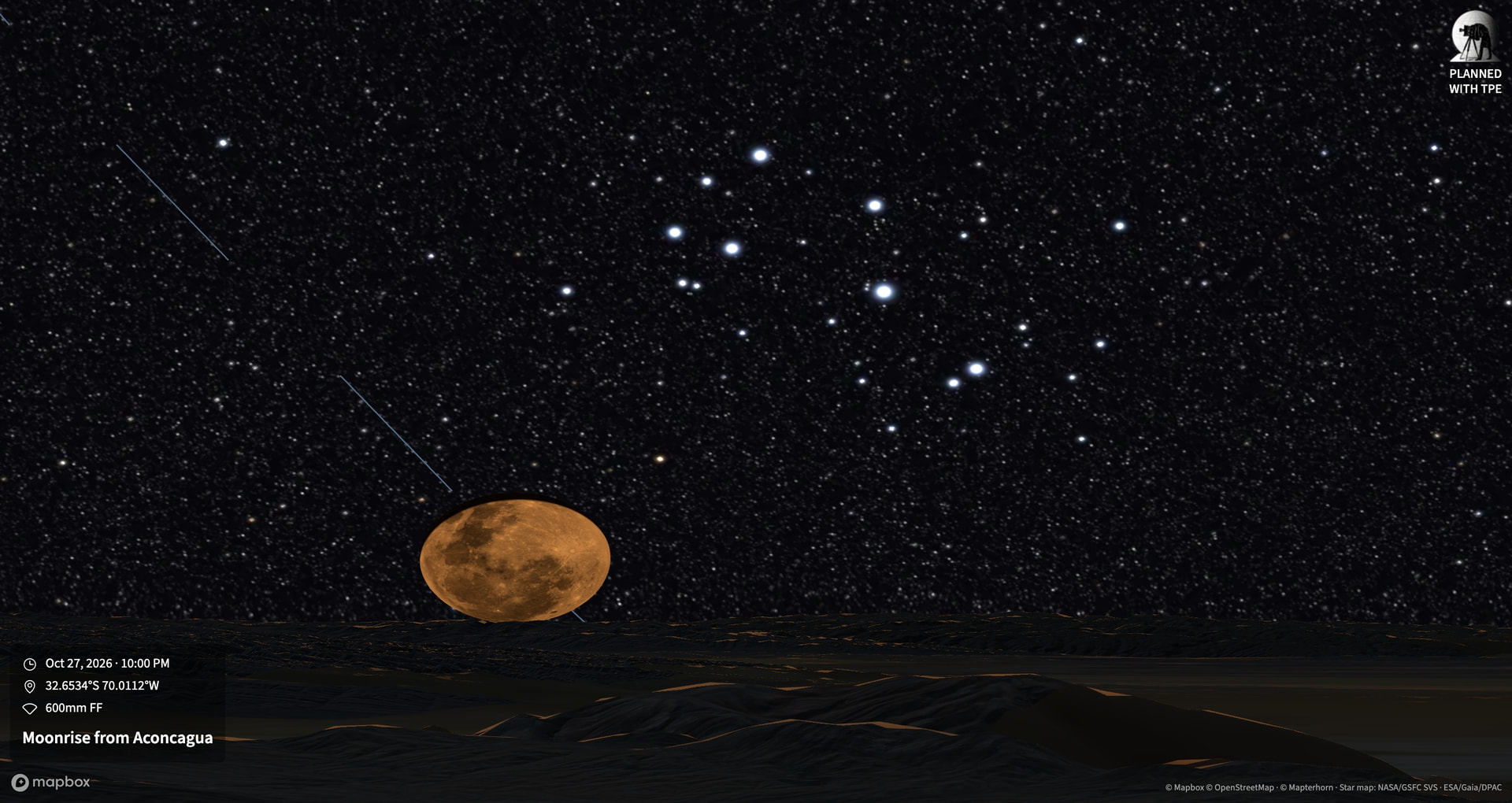
At sea level, the solar or lunar disc can appear approximately 15% shorter vertically near the horizon. From elevated viewpoints, the effect can be considerably more pronounced.
This provides a more realistic representation of the appearance of the Sun and Moon when planning horizon compositions.
Improved sunlight colours in 3D
We’ve corrected the colour rendering of sunlight, twilight glow and moonlight in the 3D views.
Low-angle sunlight now appears warmer, and illuminated terrain is rendered more naturally, bringing the web app into closer agreement with TPE for iOS.
Improved Field of View controls
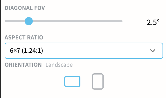
The Freeform Field of View controls have been redesigned.
Instead of setting horizontal and vertical angles independently, you can now specify:
- Diagonal Field of View, using a slider that makes both wide-angle and telephoto adjustments easier
- Aspect ratio, selected from common photographic formats
- Landscape or portrait orientation
Supported aspect ratios include 1:1, 4:3, 3:2, 16:9, 2:1, 2.39:1 and several traditional film formats, including 6×7, XPan and 6×17.
The panel also shows the equivalent full-frame focal length for your chosen diagonal Field of View.
Existing saved Shot Plans and shared links retain their original framing.
Consistent zoom levels across map providers
The standard map and Google Maps now use a consistent zoom scale.
Switching between map providers at the same zoom level will therefore show approximately the same geographic area.
We’ve also improved how Google Maps responds to automatic zoom changes when opening saved Locations and Shot Plans.
Other improvements and fixes
- More reliable Moonrise and Moonset calculations at high latitudes, including locations where the Moon’s rapidly changing declination previously caused events to be missed or displayed out of sequence.
- Improved planet rise, transit and set calculations, particularly during retrograde motion, when some events could previously be missing or significantly incorrect.
- More accurate Moon phase labels around New Moon and Full Moon, fixing occasional incorrect waxing or waning indications.
- Improved Visual Search accuracy for azimuth crossings near the horizon and high in the sky.
- Better handling of early historical dates, including years 1 through 99.
- The date picker now accepts any year from 1 to 2999, rather than limiting navigation to a small range around the selected year.
- Walking in First Person View now preserves your viewing direction, rather than unexpectedly turning back towards the secondary pin.
- Fixed a problem where sight lines and eclipse shadow outlines could be cut short after resizing the map.
- Fixed an issue that could prevent deletion of previously synchronized Library items under certain circumstances.
- Improved resilience when 3D textures fail to download, allowing the scene to continue rendering rather than failing entirely.
- Corrected Field of View diagonal calculations for wide-angle compositions.
Beta testing feedback
This release includes significant changes to both the map interface and the 3D rendering system.
I’m particularly interested in feedback on split-screen pin placement, docked maps, distant terrain accuracy with long focal lengths, and the revised Field of View controls.
The astronomical calculation changes are also fairly extensive, so please report any unexpected differences in rise/set times, Visual Search results or celestial positions, especially at high latitudes or from elevated viewpoints.
As always, thanks for helping test TPE Web!