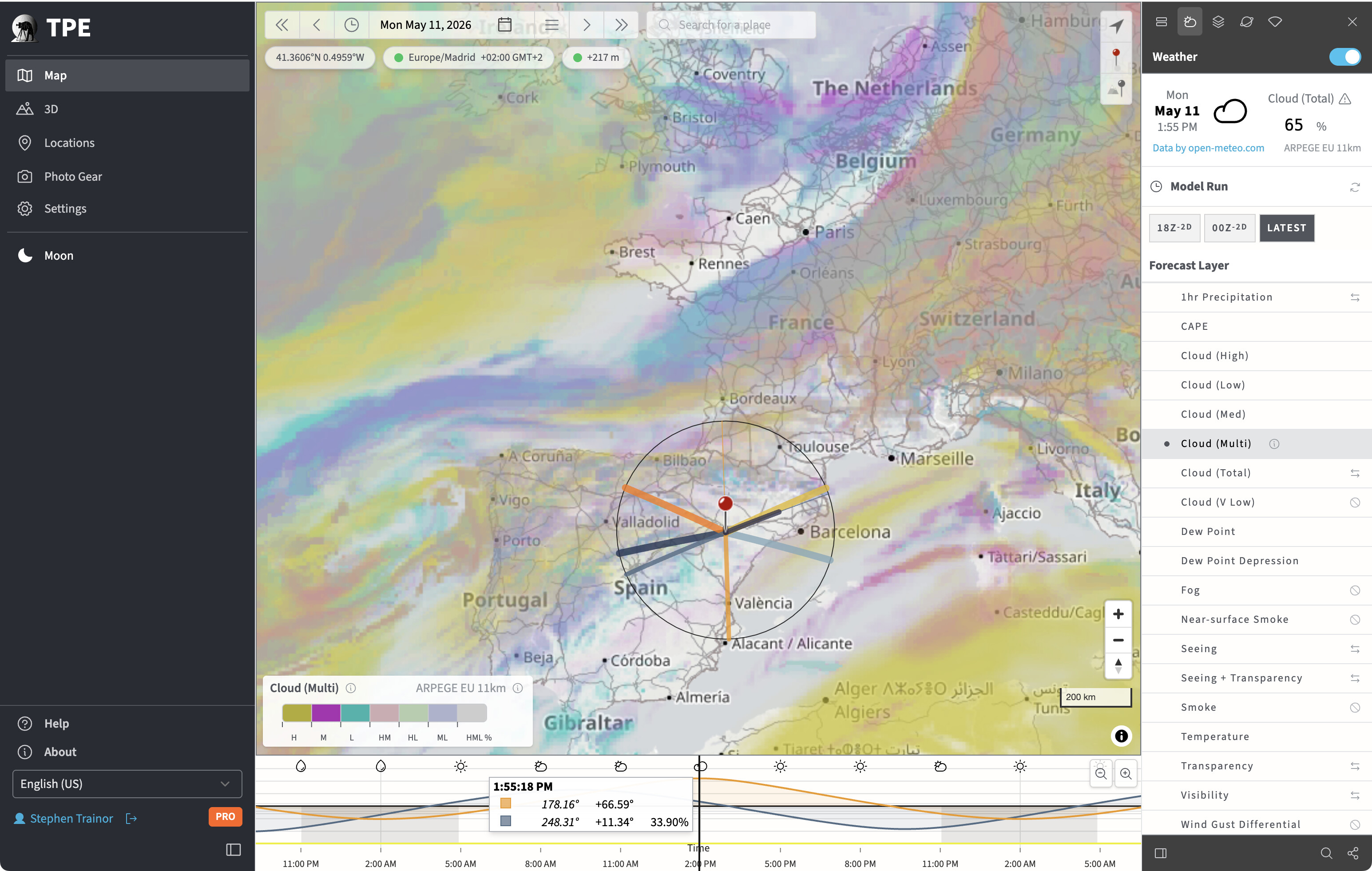
Lots of changes to the UI layout, in an effort to declutter and make provision for more major new features which will be dropping in the coming weeks.
One new feature available today: dynamic map shadows on 2D maps. This is available with any of the “Default” map styles (i.e. not available with Google Maps). Here’s a preview:
I’d love to get your feedback on the UI, the new layout, etc. If you’d like to see something change, now’s the time to shout out!
V4 looks really nice, I got to the preview site from the link in your email, when I tried logging in it didn’t recognize my user name and password. However when I went to the Beta site and logged in first from there then clicked on “Try V4” it took me to version 4 and let me use all the features. I really like the new photo features of adding cameras and lenses and seeing the Field of View on the map.
I really like the Field of View layer. A feature I’d like to see added is the field of view if you put the camera in crop mode. For example when using a 400mm lens on my Z9 and I put it crop mode the FOV would now be equivalent to 600mm due to the 1.5x crop factor on Nikon Cameras. Also when using zoom lenses I’d like to be able to change the focal length of the lens by dragging right on the map view, I know I can change the focal length by dragging the slider in the sidebar, but if I have the side bar closed I’d like to be able to change the focal length right on the map
Hi Ron - try holding the Shift key down as you drag the FOV control marker on the map - that will adjust focal length instead of camera bearing. Full options are:
FOV Drag Handle Modifier Keys
Active while dragging the green FOV handle on the map (left vertex of the FOV cone). Without a modifier, dragging rotates the camera bearing AND adjusts the subject distance simultaneously. Modifier keys narrow the drag’s effect to a subset:
Shift: Focal length + subject distance for Zoom lenses only
Hi Ron - likely just a temporary issue: both sites use exactly the same account details. Let me know if you see any persistent problem with sign-in though!
The following happens in current version as well as in the new Beta, but I’m all for moving forward with your great work. I’m on macOS Tahoe 26.4.1 using Safari 26.4.
When I’m on the Maps page and use my mouse wheel to zoom in and out, the map zooms in and out as expected.
But when I’m in the 3D page and use my mouse wheel to zoom in and out, all it does is make the 3D model bigger or smaller, and doesn’t zoom the map.
Is there anyway to change this, or is it a function of how you generate the 3D model? Because at the moment I am continually jumping between Map and 3D (and doing zooming on the Map) as I have no real feel for how much of the Map shows up in the 3D model
Hi @PeterEm - I’ll need to do some testing with a mouse to check this out. I suspect that the wheel by default will zoom the 3D camera towards the map, but not change the loaded map zoom level. It may be possible to add a modifier key behaviour to make it swap over.
The /3d page has a major update planned, so things will be changing there in any case over the coming weeks.
In terms of how much map shows up in the 3D model, it’s essentially 4 x 4 map tiles at whatever zoom level is selected. The area width covered roughly doubles each time you zoom out.
The new design should improve usability I hope - it’s much more “weather layer”-centric than before and will auto-switch between weather models as needed, so you don’t have to go hunting for which layers are in which model.
You can sort the models into your own priority order so that if it switches between models based on layer availability, it will switch between the models you prefer. You can override by selecting a model explicitly from the right-hand sidebar at any time.