Adding full support for solar eclipse has been a multi-year journey. I decided back in 2023, rather than re-using existing eclipse maps (which Xavier Jubier very kindly makes available to multiple other sites and apps), I’d build my own.
It’s taken since then to produce a fully correct “classical” map for TSE2026, perhaps the most troublesome eclipse I’ve ever encountered! But finally, this week, in the nick of time, I have it working.
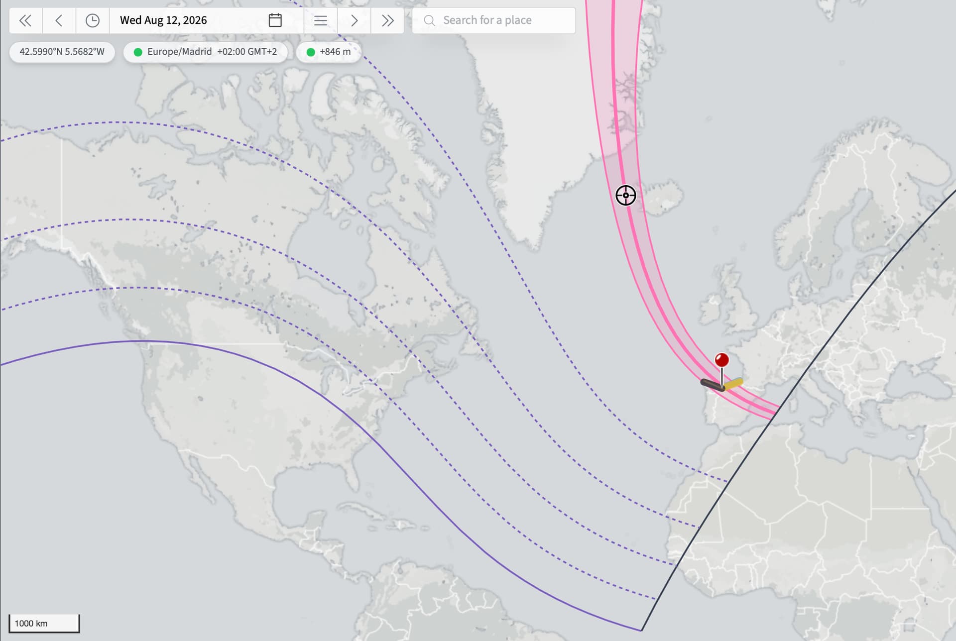
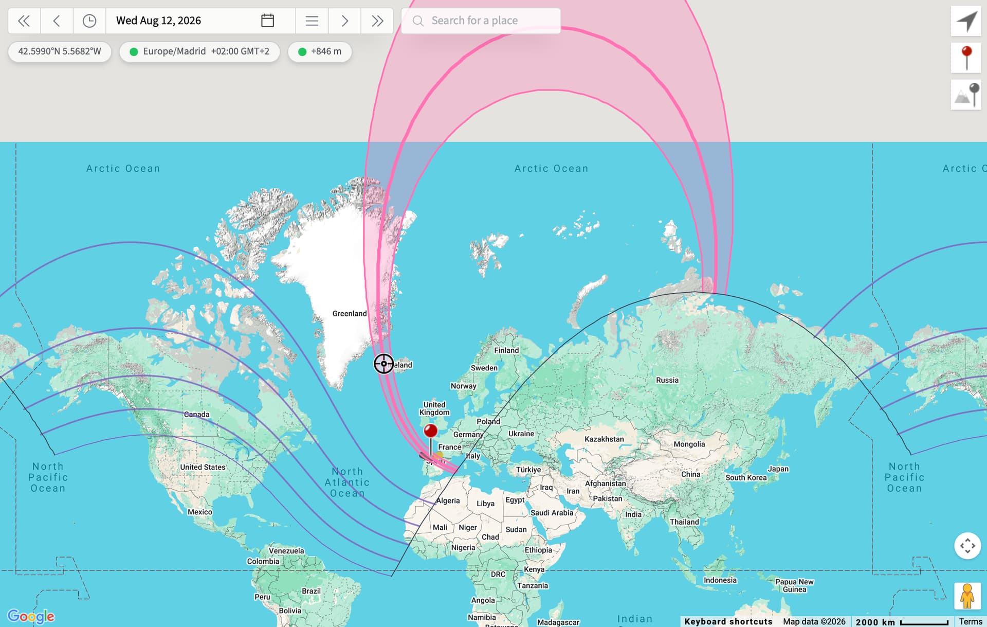
The new map fixes longstanding geometry issues at the start of the path over Siberia, where the standard Jean Meeus longitude-based algorithm in his wonderful book Elements of Solar Eclipses breaks down. This is due, I think, to the extreme shadow velocity over the Earth’s surface as the eclipse tracks northward and crosses the pole.
Every eclipse you look at either in our Solar Eclipse Catalog or in TPE Web 4.0 Preview gets a new map - either pre-generated (for speed) or generated on the fly for far future and historical eclipses.
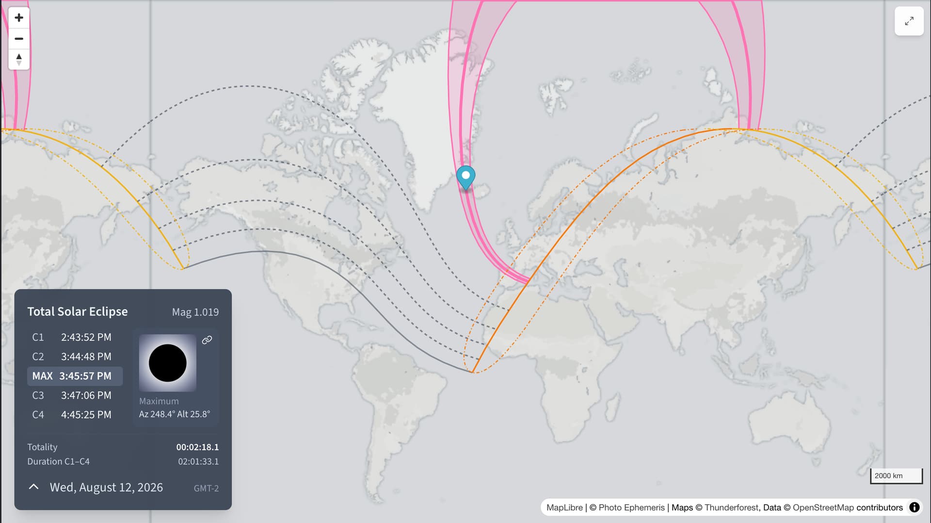
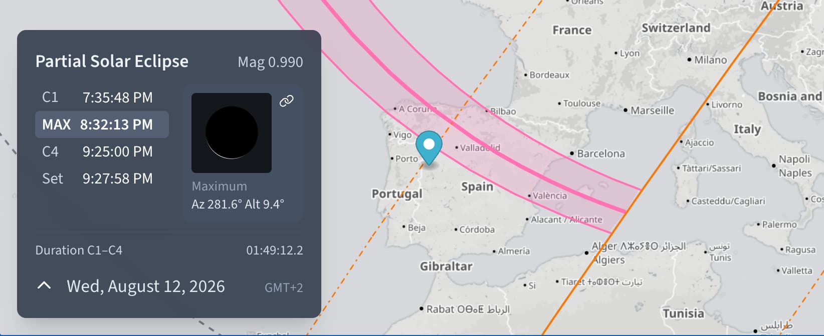
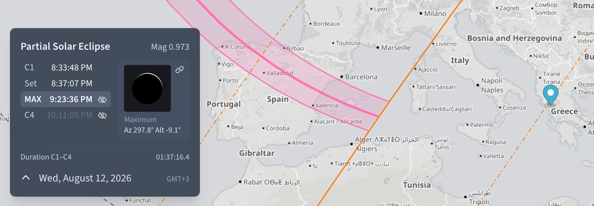
The new maps now also include the lines of maximum eclipse at sunrise and sunset, which really help to reason spatially about what’s going in during a solar eclipse, especially for high altitude events, such as TSE2026.
I’ve also added the points of greatest eclipse (globally) and the point of max eclipse at solar noon (when it occurs). The latter is when the time of maximum eclipse coincides with Solar culmination (or occasionally lower transit for polar events) - it’s useful in that it tells you “you’ll never need to look higher in the sky than this, no matter where you go to to observe this eclipse”.
If you spot any issues, please shout!