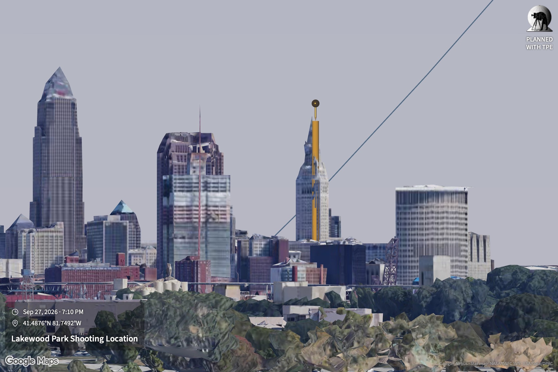
TPE Web Beta 4.8 Now Available

TPE Web 4.8 is now available. Two additions so far:

  • Declination range limit visualization – this makes using Visual Search easier
  • Open in Google Maps – as requested

Declination Range Limits

One challenge when using Visual Search has always been knowing where in the sky your target can possibly appear. If you search for the Moon in the northern sky, you’ll likely get no results unless you live in the southern hemisphere, for example.

We now show the range limits of the selected target when Visual Search is enabled so can you avoid fruitless searches that will never generate any results.

Additionally, if you do attempt a search that includes areas of the sky outside the range limits, the search will complete much more quickly than before (early return).

Sun
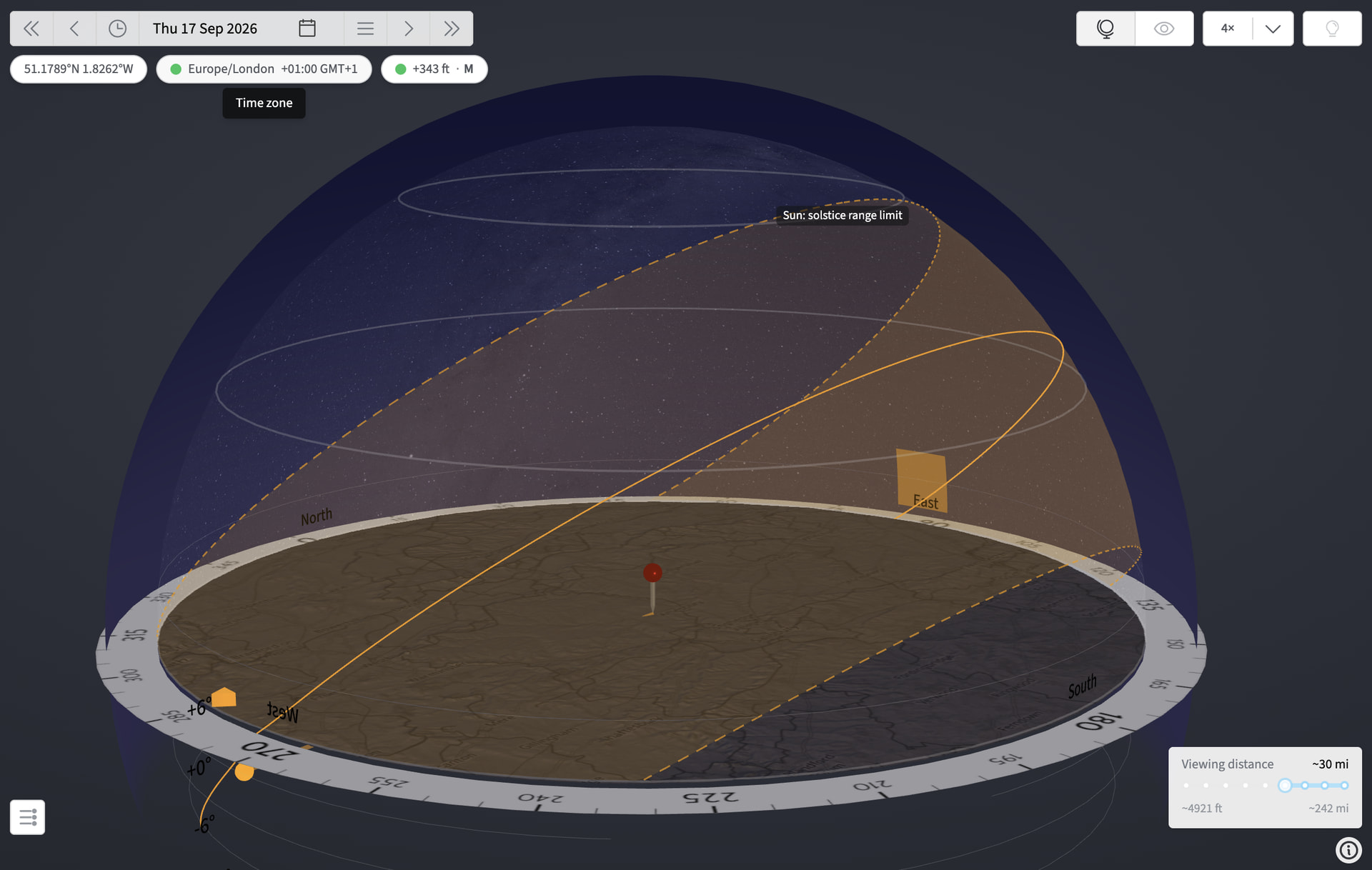
For the Sun, this concept is familiar: it is the range of movement achieved across a 1-year period and bounded by the Sun’s path on the winter and summer solstices.

We show the range limit as a translucent band, in the body color, bounded by dashed lines

Moon
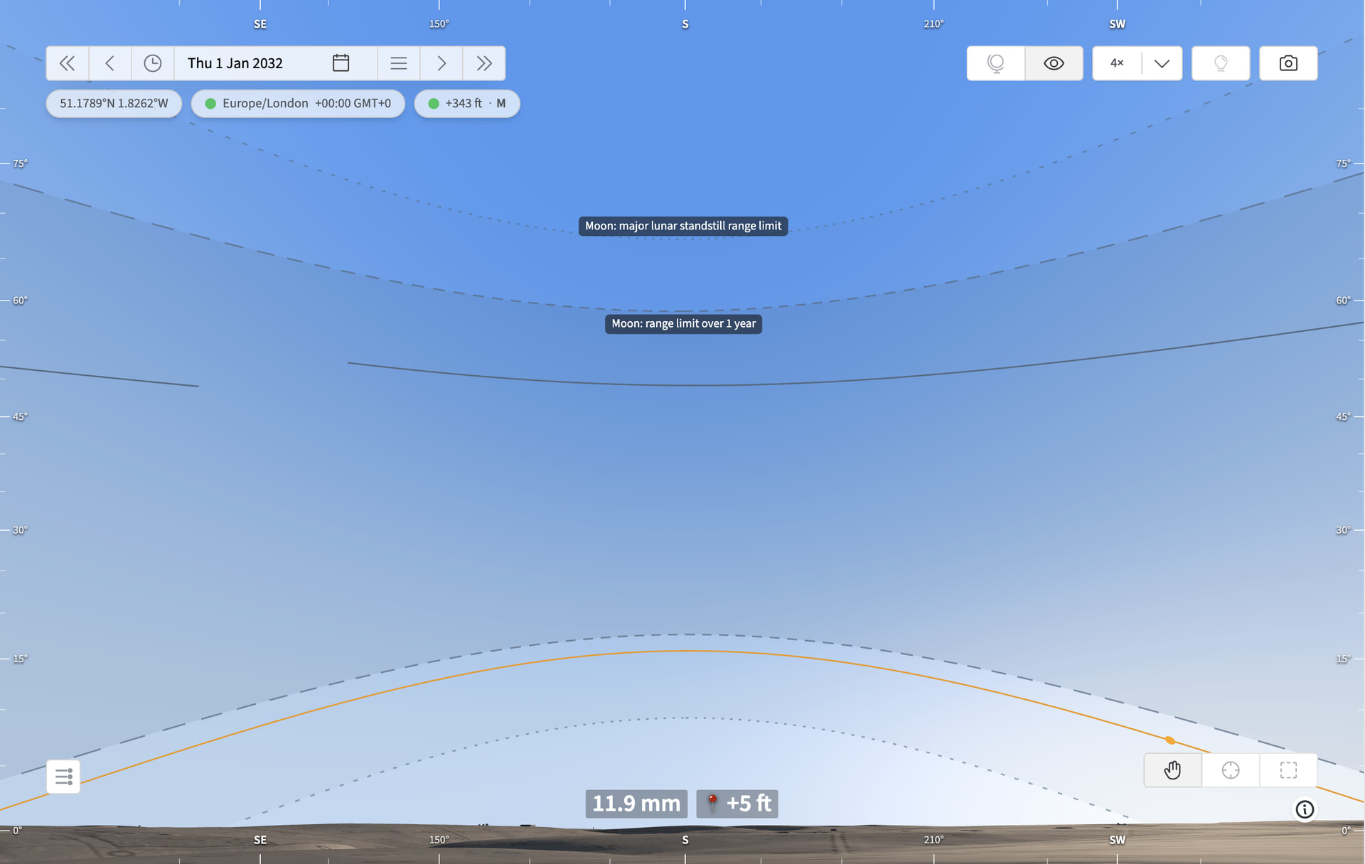
For the Moon, the situation is a little more complex. Shown above, the inner range limits (longer dashed lines) show the range of motion of the Moon in the given location over the coming 1-year.

However, over a longer time, the range of motion is wider, the widest being during the Major Lunar Standstill, when lunar declination reaches its extrema. We show this as a fainter range (shorter dashed lines) so you know that even if an alignment is not possible in the coming year, if you search on a longer time horizon, it may occur.

Planets
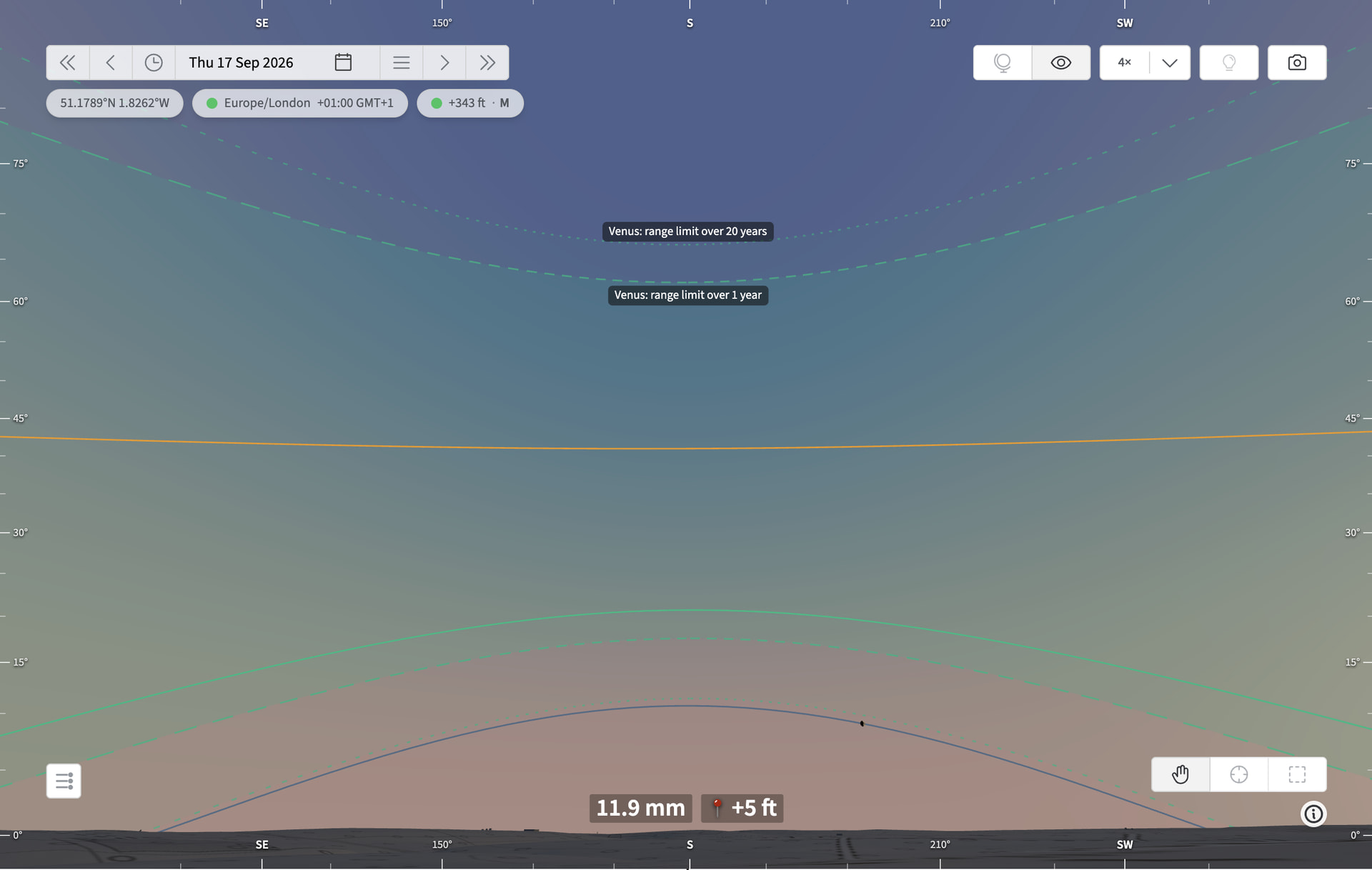
We show range limits for the planets too. Similarly to the Moon, you may see shorter and longer-term range limit. The longer term range limit considers a 20-year period – the longest that can be selected for a single Visual Search run at this time.

Open in Google Maps

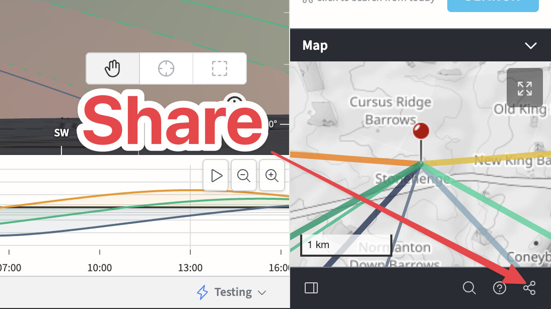
Using the Share button (bottom right) to access the Open in Google Maps feature:
A new button at the far right offers the option to open just the pin in a separate tab in Google Maps, or to obtain directions from your current location:
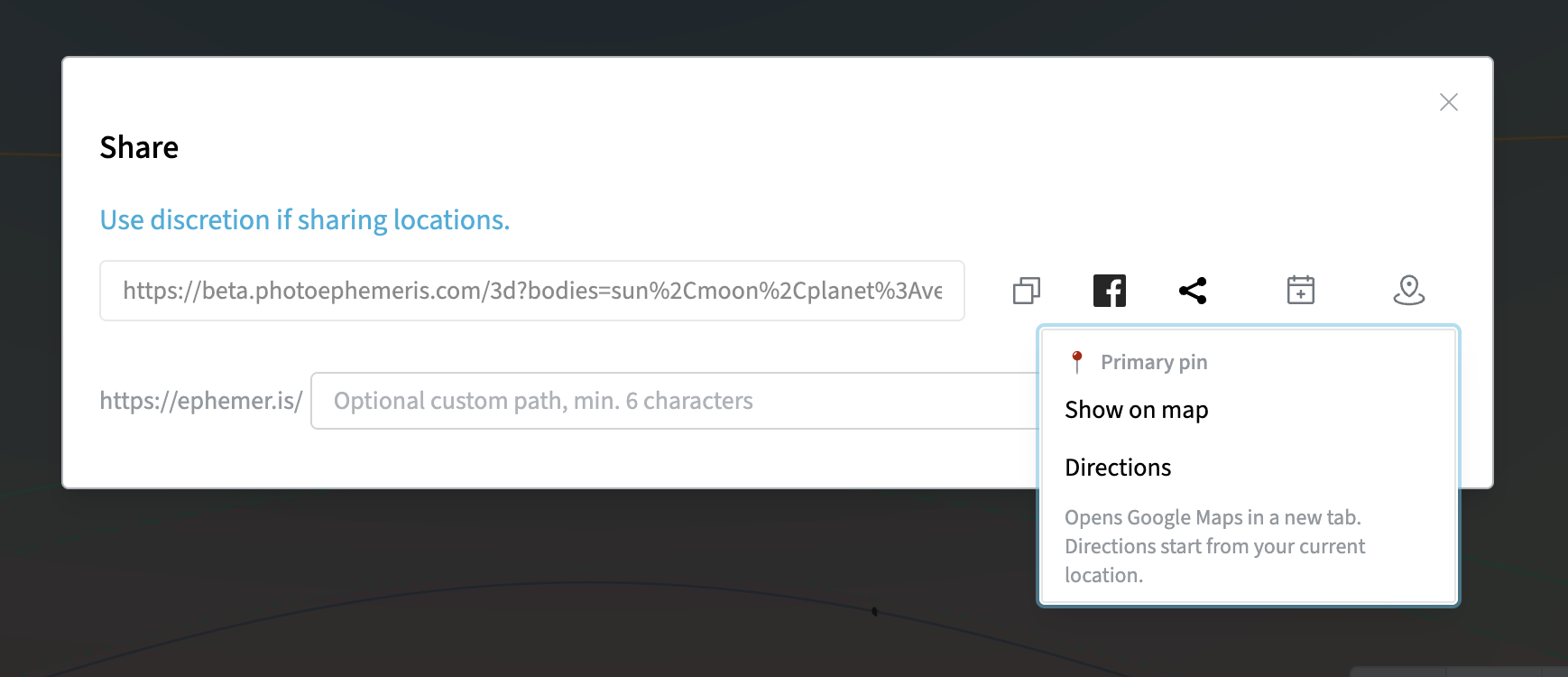
If the secondary pin is enabled, you’ll separate menu options for that in addition to the primary pin.


I’d appreciate your feedback on this new functionality. Please report any issues or bugs you find!

Stephen
1 Like

TPE Web 4.8 Beta 2

This adds support for import of marker files, .mrk, from PlanItPro. We import as many fields as we support and the imported markers land as Saved Locations.

For background see here.

Please let me know if you see any issues with this – if you see things that don’t import cleanly, please send a sample via email or message directly.

Note: Markers from China are converted to WGS-84 coordinates at import and always displayed as such on the map. The default maps always show WGS-84. Google Maps switches to GCJ-02 in China, which for now markers are not shown correctly.

The Share to Google Maps work, both in showing on the map and getting directions. Is there anyway to share to Apple Maps, I use CarPlay in my car to navigate using Apple Maps so it would be great to save to Apple Maps

Hi @ronskinner4435 - what do you envisage in terms of workflow for Apple Maps? Open in Apple Maps on the web from the web app and then save the location somehow? I’m not seeing options to do that on maps.apple.com.

An alternative might be to use Airdrop to share the pin location to Apple Maps on iOS, I guess.

You’re right, you can’t do it from the Apple Maps web site, it can only be done using the mobile app on iPhone or IPad. I thought there might be a way to add to guides or favorite it, but the website doesn’t allow that for some reason. I thought from there it would be shared with the app on my phone. Looks like the Apple Maps web site is in Beta so maybe they’ll add that feature down the line.

Oh well, 4.8 looks good!

1 Like

TPE Web 4.8 Beta 3

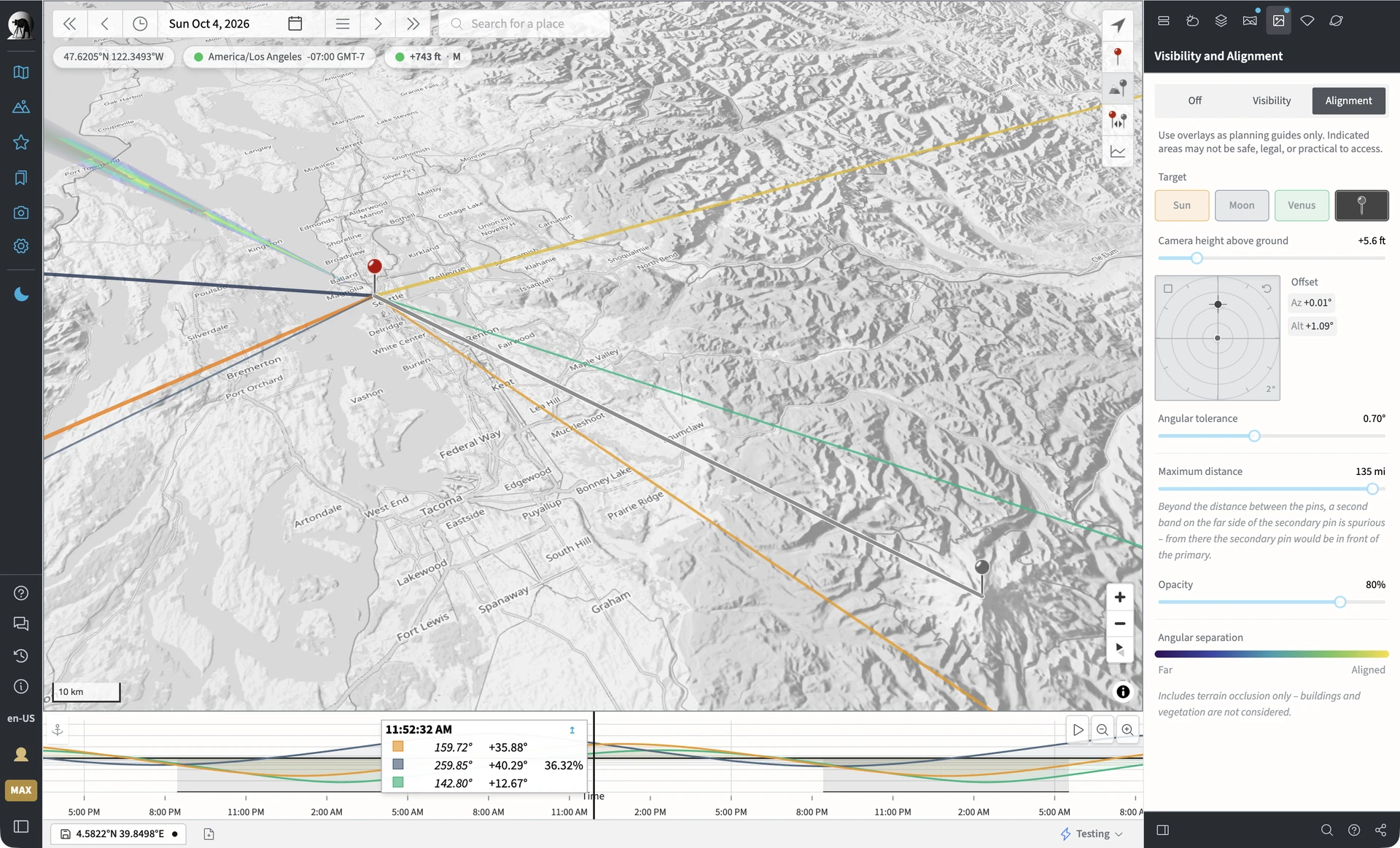
Beta 3 adds support for landmark-to-landmark alignment using the Shot Alignment tool. Examples:

  • Where can I align Mount Ranier behind the Seattle Space Tower?
  • Where can I align Monviso behind the Basilica of the Superga in Turin?

Usage

In the Shot Alignment panel, the secondary pin is now available as a “Target”. You will need to enable geodetics first in order to select it.

Place the secondary pin on the far landmark. Place the primary pin on the near landmark. Adjust the tolerance as desired, and increase the Max distance as needed.

The alignment heat map shows where you can stand (within the configured tolerance) to align the landmarks. There is no change over time naturally – the landmarks don’t move like the Moon.

You can choose an alignment by clicking the map and selecting it from the inspector as before. There’s now also an “undo” option, shown in two locations - a pop-up “Toast” after selection and a permanent link in the Shot Alignment panel under the Target selection controls – this allows you easily to reset the pins back to the original two landmarks if you want to inspect a different candidate shooting location.

Once you have a shooting location that aligns the landmarks, the next natural step in the workflow is to move to the 3D page and use First Person View to check out the composition, adjusting as needed.

You can then use Visual Search to find when the Sun, Moon etc. might provide you a triple alignment of Celestial Target, Far Landmark and Near Landmark.

Tips

  • If the near landmark is a building, be sure to set an appropriate height for the primary pin (e.g. the height of the dome of the Superga) in the Geodetics panel; the choice is somewhat subjective and depends on the alignment you’re seeking
  • Use the offset control to set a relative angle between the two landmarks, particularly for altitude. If the offset is zero, then you’re saying you want the primary directly in front of the secondary pin. However, usually, you will want the far landmark slightly above the near landmark (e.g. the dome of the Superga contained within the summit of Monviso), in which case set a small positive altitude offset. At long distances with a telephoto lens, usually 0.25 - 2 degrees is the right sort of range.

@fabiofoto – let me know how you find it!

1 Like

Not sure if I’m doing this right but when testing out 4.8 Beta 3 using the gray pin as a target, I set the gray pin height to the height of the building and instead of the gray pin floating on top of the building the gray pin is sitting on top of a yellow post, I sure hope you do a video on how to use some of these features cause I don’t know what I’m doing!!! :grin:

Hi Ron – will definitely be doing a video, as usual. I usually don’t do them until the features are locked in and beta testing is over.

Generally, there’s usually no need to set a height for the secondary pin for a building if you’re going to use the buildings shown in the /3d page. I’d recommend clearing it, unless there was some other specific thing you need it for?

However, sometimes a building may be missing or not represented correctly in the 3D sources, so we draw a cylinder to show the configured height above the ground in those cases – but here, it’s redundant.

What 4.8 specific feature were you looking to use in this particular case?

Stephen I am deeply honored to have had you working on this tool that I had recommended. I went through a quick test and I have nothing to say more than it works perfectly. I can state it simply because I worked at the alignment you also mention in your post (Basilica di Superga and Monviso). The tool takes me exactly in the spot that we had identified, found empirically and we are using for our spectacular shots (last time less than 10 hours ago - results coming soon with the waxing moon setting aligned with the two landmarks). This tool comes to improve two important aspects: first is to unchain fantasy with many more double landmark alignment plannings and/or enhancing the once already identified; second is to save time (and money) with demanding reconnaissances looking for the right spot. With this tool, combined with the street view (changing the map layer to Google), checking on the spot will be limited to much less cases. Stephen, thank you very much!

3 Likes

Wasn’t looking for anything specific, every time you add something new I like to try it out and see what it does. I gotta say you’ve added a lot of great new features in the last few months! :+1:

1 Like

I hope you had a successful shoot Fabio!

1 Like

TPE Web 4.8 Beta 4

Terrain and Map tile-loading resilience

  • In 3D, map tiles load individually, so one failure no longer results in the entire scene
  • The elevation refetch loop is fixed – eliminates an endless loop condition on an elevation load failure
  • For Orbit mode, navigating away and then back to the 3D page preserves and restores the Viewing distance slider setting (unless you adjust the map zoom on the home page in the meantime)
  • The first-person view gets the “Terrain incomplete” retry and warning UI in the event some part of the elevation data fails to load (e.g. a missing tile or network issue)

This beta drop is primarily internal improvements and some added error/warning UI for loading failures.

Please let me know if you see any issues!

Ok I was trying the new Beta 4 stuff out and everything seems to be working well, but I ran into a bug while testing, for first person view I was using photo realistic view and while testing out the viewing distance in Orbit view I would switch back and fourth from first person to Orbit view it was working fine and I tried it one more time and when it went back to first person view it wouldn’t show the buildings in photo realistic view, it said it wasn’t available and showed the buildings in terrain mode even though the setting was set to photo realistic, I switched back and forth from Orbit to First Person and then to map mode and back to first person and it kept showing the terrain view. To fix it I changed the setting to terrain view then back to photo realistic view and that fixed it. I think this happen once before in a previous beta, but it’s really random and most of the time works fine, maybe it just happened cause I was going back and forth between Orbit and First Person that I normally wouldn’t do

On a different subject, are there any shortcut keys to quickly close the left and right side panels, I know I can click the icons but shortcut keys would be quicker

Hi Ron,

That sounds like a transient network error that kicked you out of photorealistic mode. It’s a bit hypersensitive at the moment – I need to look into how I can reduce that. Switching out and back to photorealistic is the correct recovery step.

Keyboard shortcut to toggle the sidebars: F

Let me know how that works for you.

Stephen

1 Like

Thanks the F shortcut worked for toggling the sidebars, is there a list of shortcut keys we can use in TPE, I searched for shortcut keys in Help but no results were found.

Hi Ron – I’ve spent the day reviewing keyboard shortcuts, fixing a few related bugs and adding a help article. You should see it in the help results now. There are quite few documented there!

1 Like

TPE Web 4.8 Beta 4

New

  • Geodetics switch in the Geodetics panel. You can place or remove the secondary pin from the panel on the map and on /3d, so turning geodetics off in the 3D view no longer means going back to the map.
  • g works anywhere on /3d. Every mini-map (/3d, Moon Simulator, Celestial Targets, Eclipse Simulator) now also takes g and s, as the main map does.

Changed

  • Previous and next event moved to Shift+P and Shift+N. Plain p and n still step a day. The old Cmd/Ctrl+P also opened the print dialog, and Chrome never passed Cmd/Ctrl+N to the page.
  • The pin-height strip under the /3d scene is gone. The Geodetics panel shows the same heights.

Fixed: saved items and sync

  • Saves reach your account straight away. Plans, searches and locations now upload a few seconds after they’re saved, on any page,
    instead of only when the Library opens. They also upload when you switch tabs or leave the page, wait while you’re offline, andretry if an upload fails.
  • Storage problems are called out. When the browser can’t store saved items, a toast identifies the cause: site data blocked, storage full, or connection lost (with Reload). A failed save is now notified instead of silently doing nothing, and the misleading “Locations unavailable” dialog is gone.
  • It’s no longer possible to try to add to a deleted list. It no longer fails silently, and the Library no longer says success when nothing was in fact written.

Fixed: 3D view and Moon simulator

  • They now recover on their own after the browser drops their graphics context. They retry at 1s, 3s and 8s, and again when you return to the tab. Before, they could stay stuck on “graphics context lost”.
  • A render error now shows the right error panel. It used to show a false “context lost” panel.

Fixed: keyboard

  • s does nothing while Geodetics is off. Before, it could swap your pin with the hidden one.
  • Browser shortcuts work again on the map and timeline. Cmd/Ctrl+C, S, G and page zoom now go to the browser. Page Up and Page Down step the timeline 10 minutes. The Alt-hold previews no longer interfere with the browser’s Alt behaviour.
  • Shortcuts are more predictable:
    • Caps Lock no longer changes what they do
    • Holding a key no longer auto-repeats
    • Shift no longer gets stuck “held”
    • Tabbing to the map takes one press, and its arrow and zoom keys work straight away.
  • Cmd no longer stays “held” after switching apps. It is read from the click or drag itself. Cmd+Enter now does the same as Cmd-click.
  • Escape closes one thing at a time. A search box is left first, before the panel around it closes. During a drag, Escape cancels the move without closing the dialog. It also now closes the date picker’s calendar.
  • Lists work from the keyboard:
    • Enter or Space opens a solar eclipse row in the Solar Eclipses list
    • Keys on a row’s own checkbox or button no longer also act on the row.
    • Space no longer scrolls the page.
    • Shot Plan cards show a focus outline.
  • Typing Korean (or with any input method) no longer submits a field early.
  • Location search suggests as soon as you paste, and a late lookup no longer refills a list you’ve just cleared.

Thanks those shortcut keys come in handy!

1 Like

If I’m in Map view and hit F it goes to Full Screen view and closes the left and right sidebars as it should, but then if I hit the 3D view icon it goes to 3D view but both sidebars reappear so it’s leaving Full Screen view.

If I’m in 3D view and hit F I go to Full Screen view and the sidebars are closed, now if I go back to Map view the left sidebar stays closed, but the right sidebar returns

Hi Ron – that should be fixed now in the current beta, if you want to reload and retest? Thanks for the report!

1 Like